 |
||||||||||||||||||||||||||||
 |
 |
 |
||||||||||||||||||||||||||
|
|
|
|
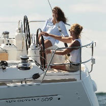
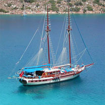
Cyclades Yacht Charters | |||||||||||||||||||||||||
We specialize in yacht charters in the Cyclades and the Aegean Sea. We have a great range of sailing yachts and motor boats available for bareboat charter and can also offer skippered and crewed charters. Many of our boats can be hired by the day rather than for a full weeks charter. Please contact us directly for our great value late booking deals in Cyclades. We have boats in the following locations; Athens -Lavrion, Athens - Kalamaki, Syros, Paros, Santorini, Epidaurus, Mykonos and Poros General Info - The Cyclades is the central/southern group of islands in the Aegean Sea. They can be split into the following three groups; Northern Cyclades - Kea | Kithnos | Andros | Tinos | Yiaros | Syros | Mykonos | Delos | Rinia Central Cyclades - Serifos | Sifnos | Andiparos | Paros | Naxos | Dhenoussa | Iraklia | Skhinoussa | Koufonisia | Amorgos Southern Cyclades - Milos | Kimolos | Folegandros | Sikonos | Ios | Santorini | Thira | Anafi Athens is a good base for a yacht charter in the northern Cyclades. Consider boats from Syros or Paros for exploring the central and southern islands Get a quote for your Cyclades yacht charter here. Or contact us by email |
||||||||||||||||||||||||||||
 |
 |
|||||||||||||||||||||||||||
 |
 |
 |
 |
|||||||||||||||||||||||||
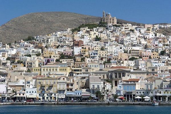
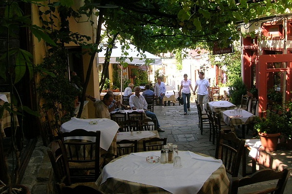
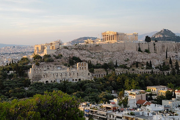
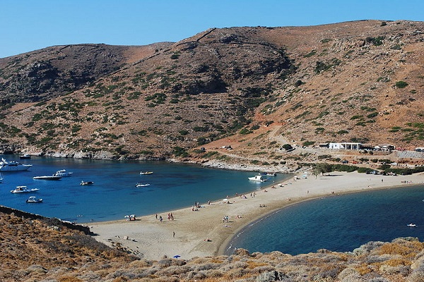
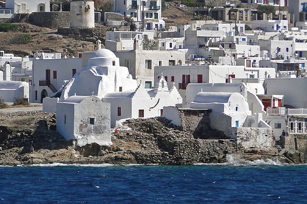
| The Cyclades Islands; Kea Island is very close to Athens, it is a mountainous island and small valleys, planted with fruit-trees and vines, break up its coarse beauty. This is quite holiday spot and its numerous bays and attractive villages offer quiet relaxation in contrast to the other more popular islands in the Cyclades. Hora is the capital of the island and home to the Archaeological museum which hosts a number of Cycladic period finds. Greek mythology has it that Kea was the residence of the nymphs of the forest springs who embodied the "liquid element". The gods envied its beauty and sent a fearsome lion to persecute the nymphs who took escaped to Karistos. Then a long period of dryness began, water levels decreased and the vegetation withered. The islanders asked for the help of Apollo's son Aristaios. He came to the island and built a sanctuary to honour the Ikmaios Zeus, the god of rain. The gods were pacified and the draught was reduced allowing agriculture to thrive once more. Korissia is the port of Kea and is situated at the southern end of the Limin Ay Nikolaou in the NW of the island. The houses of the port are built around a bay, on a small plain. You can moor stern or bows to the quay keeping clear of the ferry berth. As the Meltemi blows straight on to the quay ensure your anchor is holding. Vourkari further NW in the bay also has a quay that you can moor stern or bow to. There are several other possible locations to anchor in within the bay if the weather is calm. Fuel in available in Korrisa and provisions and tavernas can be found in both Korrisa and Vourkari. During the summer months the bay is more often than not crowded with yachts from nearby Athens with picturesque Vourkari being the most popular. Loulis, the capital of Kea, is situated 5.5 km from Korissia. Many of the old mansions are built next to the ruined castle. The ancient acropolis of Loulis and the impressive sculpture of Kea's Lion are both worth a visit. As are the churches of Panayia Gamila and Panayia Revmatiani and the ruined monasteries of Agia Anna and Dafni. On the coast further to the south there is an anchorage at Ormos Pisa, there are no facilities here. Further south still is the anchorage of Ormos Kavia, open only to the south it provides good shelter from the Meltemi. The taverna run by Manos can provide provisions, fuel, gas, water, ice and showers. Ormos Polais is in the SE of the island. This anchorage provides some shelter from the Meltemi but holding is not always good. There are ruins ashore including those of a temple. Khalidhoniki is a small cove in the NE of the island with good shelter from the Meltemi. The small village ashore has a taverna. Orgias is a small cove on the northern coast that should only be used to anchor in calm conditions. There are no facilities. The barren, rocky island of Kithnos lies 6 miles to the south of Kea. Legend says that the Dryopes, who came from Eboea, settled on Kythnos in the 11th century BC. In classical times the island was a well organized city state praised by Aristotele. Excavations have found a site dating back to the Neolithic or even the Mesolithic period, making it the oldest habitation in the Cyclades. In more recent times, around 200 BC, the island was frequently attacked by the Romans although they never succeeded in taking it. The island is 19 km long and covers an area of about 80 square km. The only green shade in the heat of the summer is provided by many the fig trees. Today the island is popular with Greeks who head for its many Spas that are located in the NE of the island. The capital of the island, Hora, stands inland on a hillside plateau, it is a typical Cycladic village with beautiful churches containing fine woodcarving, sanctuary screens and icons. On the western coast lie the bays of Apokriosis and Fikiadha. Good holding and shelter in attractive surroundings. There are good white sandy beaches. No other facilities. Further to the south lies the island's port Merika. Moor stern or bow to the quay inside the ferry berth. The SW end of the quay shallows and yachts should go bows to. Fuel is obtainable by taxi. Most provisions are available in the village. There are several waterfront tavernas. The anchorages of Kanala and Ay Nikolos can be found in the south east of the island. They should be visited in only calm weather. There are no facilities. Further to the north on the east coast are the anchorages of Stefanos and Ioannis. They offer good shelter from the Meltemi but holding is poor in places. A limited water supply is available at Stefanos. No other facilities. The village of Loutra is in the NE of Kithnos. Go bow or stern to off the quay. Water is available on the quay and most provisions are available in the town. There are several tavernas. Siros is another almost barren island. The north is rugged and largely uninhabited while the south has gentler slopes and is cultivated towards the coast. Ermoupolis is on the east coast. Go bow or stern to the quay avoiding the ferry berth in the east of the harbour. Reasonable shelter except with winds from the SE when a large swell comes into the harbour making it at best very uncomfortable and at worst dangerous. Another hazard is the sewage that flows into the harbour making it very smelly in the summer. Non potable water is available on the quay. Drinking water comes via a tanker. There is good shopping within the town. Plenty of tavernas around the harbour and in town. As the past capital of the Cyclades the town has a certain grandeur with many fine buildings. The small island of Nisos Gaidharos lies just to the east. A small cove in the SE corner provides good shelter from the Meltemi. There are no facilities. Varis is in the SE of Siros. Good holding and shelter from the Meltemi. There are several tavernas on the waterfront. In the SW lies the sheltered bay of Finikas. Go bow or stern to of the pier or anchor off. Holding is good. There is water on the pier and electric can be connected. Showers and toilets on the pier. Some provisions are available in the village. This is a particularly place and well worth a visit. Further to the N is Galissas. There is a small mole to the south of the bay, depths are shallow so take a long line to it. There is a mini market and tavernas ashore. Kini lies further to the north. There is a taverna ashore and limited provisions are available. Andros is the most northern island in the Cyclades. It is mountainous and heavily wooded with limited cultivation. Gaviron is on the NW coast. You can anchor in the north of the bay or go bow or stern to or alongside the quay. There is good shelter from the Meltemi. Water is available from the village and there is fuel on the quay. Most provisions can be obtained in the village. There are tavernas on the waterfront and in the village. Batsi is a small harbour 2.5 miles SE of Gaviron. Go bow or stern to the quay or anchor in the N or W of the bay. There is water on the quay. Fuel and most provisions can be obtained in the village. There are tavernas on the beach, around the waterfront and in the village. Further to the south is the open bay of Palaioupolis. Anchor to the north of the bay where the best shelter from the Meltemi is. The waters are crystal clear and surroundings impressive. Kastro is on the E side of the island. The harbour is open to the Meltemi and entry can be difficult. Go bow or stern to behind the mole. Water, fuel and provisions can be obtained from the village. There are tavernas around the waterfront and in the village. Kastro is the capital of Andros. The walk from the harbour, around the bay to the village will be rewarded as the maritime, archaeological and modern art museums are all worth a visit. 6 miles to the south of Kastro is the open bay of Korthion. It is possible to anchor in the bay but there is little protection from the Meltemi and the accompanying swell is at best uncomfortable and could be dangerous. There are several tavernas ashore and limited provisions can be obtained. Tinos is yet another rugged mountainous island lying just to the south of Andros. The island is wooded and many of the slopes have been terraced there is extensive cultivation. The main port and capital is Tinos. Go bow or stern to the quay to the north of the inner harbour avoiding the ferry berth. There is good shelter in all but southerlies that produce some swell. Wash from the ferries can be uncomfortable. There is water on the quay and the locals claim it to be the purest in Greece - a claim made by several other places. Fuel can be obtained in the town, as can all provisions. There are plenty of tavernas close to the harbour. Panormos lies on the NE coast. Go bow or stern to one of the two piers, care is need with the smaller pier, as there is less than 2m depths except at it extremity. There is only limited protection from the Meltemi and it should be avoided when it is blowing. Further to the south lies Mykinos. Perhaps the most popular tourist spot in Greece. It capital and port go by the same name and it is the town that is the island's main attraction. Go bow or stern to the quay in the NE of the harbour. The bottom is weed and it is difficult to get the anchor to cut through. There is limited protection from the Meltemi and some consider the harbour dangerous. Mini tanker can deliver water and fuel. There are many shops in the town and all provisions can be obtained. There are numerous tavernas varying in both quality and price. Just over a mile to the north there is a modern marina. This provides good all round protection. Ornos bay is on the south coast. Anchor in the north of the bay, the bottom is sand and weed and poor holding in places. There is a supermarket nearby and several beachfront tavernas. Kalafatis, further to the east provides good protection from the Meltemi but is open to the S and E. There is a taverna ashore. On the north coast is the large bay of Panormos. It cannot be used in the Meltemi season. There is a taverna ashore. Rinia lies to the west. Skhinou is a bay on the E coast. Anchor either in the north on sand taking care of the rocks. There is good shelter from the Meltemi. Or in the south but there is no protection from the Meltemi here. There are further anchorages at Chapel Bay, South Bay and Miso. There are no facilities at any of these anchorages. Serifos is barren in the main but there are several green valleys around Livadhi on the east coast of the island. Go bow or stern to the jetty in the SW of the bay. If the Meltemi is blowing the S side of the jetty is preferable. There is reasonable protection from the Meltemi. There is water on the jetty and fuel can be delivered by mini tanker. Most provisions can be obtained in the village. The natural surroundings are pleasant, the bay lined with trees and the view up the hill to the whitewashed buildings of the Chora. Koutala is an open bay on the S coast of the island and provides good protection from the Meltemi. Anchor in the north of the bay just to the E of the village. There are foul chains immediately in front of the buildings. Sifnos lies 7 miles to the SE of Serifos. It is a hilly island with the highest peak, Mount Ayios, rising to 694m. The west coast is barren but the east coast is greener and cultivated in places. In the past Sifnos was rich thanks to its gold and silver mines. A geological catastrophe, still not understood, destroyed the mines and led to the island's decline. Today the island has become known for its whitewashed settlements, its remarkable cleanliness and its superb beaches. Yeoryios is a narrow inlet in the NW of the island. It is exposed only to the W and offers good shelter from the Meltemi. Anchor fore and aft at the head of the bay as there is no room to swing. There are a couple of tavernas ashore. Further south is the bay of Kamares. Berth bow or stern to the quay between the two moles. The bottom is hard sand with weed and rocks. Holding is fair at best. Alternatively anchor at the head of the bay. There is good shelter from the Meltemi although wind fro the W produces some swell. There is water on the quay. Most provisions can be obtained subject to delivery by ferry. There are a number of decent tavernas. Vathi is a landlocked bay further south down the western coast. This is the best all round shelter on Sifnos. Anchor in the N of the bay, good holding on sand and weed. Water is available and there are several tavernas. The setting is very attractive, the waters a translucent turquoise. Fiikiadha is on the island SW tip. Anchor to the N of the inlet with a long line ashore or go bow to the pier below the chapel. Apart from the chapel the place is quite deserted. Plati Yialos is a bay on the SE coast. Anchor in the NE corner, the bottom is sand and rock and the holding patchy in places. There are tavernas and hotels on the beach. Faros is a little further to the NE and provides good shelter from the Meltemi. Anchor at the head of the bay off the village or in one of the coves either side of the entrance to the bay. The bottom is sand and weed and provides good holding once through the weed. There are limited provisions and a few tavernas in the village. This is another lovely setting with hills surrounding the bay. The waters are good for both swimming and snorkelling. Kastro is an open bay lying under a medieval village. It is only usable in calm weather. If you cannot get to it by yacht it is worth a bus trip from other locations on the island. There is a deserted anchorage on the south side of the uninhabited island of Dhespotico offering good shelter from the Meltemi. Ormos Dhespotico lies between the islands of Dhespotico and Andiparos. The two islands provide good all round shelter. Anchor in the north in 2-4m where sand and weed provide good holding. There are several tavernas on the Andiparos side. To the NE of Andiparos is a narrow channel. Anchor in the cove of the village. There are several tavernas and some provisions can be found in the village. Paros is a large oval island mainly barren. It remains a tranquil destination with some of the most charming villages and best beaches to be found in the Greek islands. The island was in the hands of the Cretans when the Ionians arrived in about 1100 BC from mainland Greece subsequently destroying the Cretan civilisation. One hundred years later Arcadians arrived on the island, under a leader known as Paros. The mix of Arcadians and Ionians produced a race that developed the island's agriculture and expanded on the neighbouring island of Antiparos, which was then called Oliaros. Paros became into a major maritime power controlling sea communications in the Aegean. In the 6th century, the neighbour island of Naxos replaced Paros as the centre of power in the Cyclades. It was only natural that war should break out between the two islands and continue for many years. Paroikia is the main port and care is needed in the approaches with a number of rocky outcrops and reefs. Berth bow or stern to in the inner harbour. If the harbour is crowded it is possible to anchor in one of the two bays to the north, the one to the NE providing better shelter from the Meltemi. Good holding in sand and weed one through the weed. There is water on the quay and fuel can be delivered by mini tanker. All provisions can be obtained from the town. There are numerous tavernas to choose from and other restaurants catering to more cosmopolitan tastes. A visit to the old quarter around Kastro is rewarding. Naousa is a large bay on the N end of Paros with a choice of anchorages. The village of Naousa has a small but busy harbour. Yachts should go on the outside of the mole. There is water on the quay. The village will be able to supply most provisions and there are several good tavernas. On the E coast is Piso Livadhi. Go bow or stern to the breakwater with a long line. It is open to the SW and becomes untenable with strong winds from this direction. There is water one the mole and limited provisions from the village. The tavernas around the waterfront have wonderful views across the harbour. Aliki is a bay on the SW coast of Paros. Anchor in the bay, the piers have insufficient depths for a yacht. There is a hotel and a taverna ashore. Naxos is the largest of the Cyclades. It is mountainous island but has numerous green plains, fertile valleys and long sandy beaches with crystal-clear turquoise waters. According to mythology Zeus, king of gods, grew up in Naxos, as did his son Dionysus, god of wine and feast. Dionysus loved Naxos so much that he made it a fertile land, full of vineyards, producing a wine of excellent taste and fine quality. There are several possibilities for mooring in Naxos's harbour, under the breakwater in the NE corner, the bottom is sand, rock and weed. Go bow or stern to in the new basin, really only suitable in calm weather, the bottom is sand and rock with poor holding in places. Anchor and take a long line ashore On the NE side of the isthmus. Good holding and shelter from southerly winds but open to the Meltemi. Water and fuel are available in the harbour. Showers. Most provisions are obtainable in the town and there are many good tavernas. Naxos is the safest harbour on the island and should be used as a base if exploring inland. The anchorages of Ayios Prokopiou, Kouroupa and Kalando offer some shelter but there are no facilities ashore. Apollonia is near the NE tip of Naxos. Go bows to the outer part of the breakwater taking a long line to the shore. There is reasonable protection from the Meltemi. There are tavernas in the small village and some provisions can be found. Dhenoussa lies 9 miles to the east of Naxos. Ormos Roussa is a bay on the E coast. Anchor in the N corner for the best shelter from the Meltemi. Limited provisions can be found ashore. Dhendro is on the south coast and offers good protection from the Meltemi. There are no facilities. Stavros lies just to the west, less protection but some provisions can be found ashore as can a taverna. Iraklia lies 3 miles to the south of Naxos. Ayios Yeoryios is a deep inlet in the NE of the island. Go bow to the short mole or anchor off. Good holding on sand and rock. There is a taverna ashore in this very attractive setting. Pigadhiin is in the SE. It should only be used in calm weather when it too is an attractive setting. Skhinoussa is a small island one mile to the NE of Iraklia. Mirsini is the ferry port. Go bow to the quay north of the ferry berth or anchor of. The bottom is sand and weed with poor holding in places. There are several tavernas ashore. A walk up the hill to the Chora is a must. There are a further 2 bays to the south of Mirsini that should only be used in calm weather. Koufonisia is actually two islands, upper and lower. There is a bay on the NE tip of the upper island that is open to the E and provides some shelter from the Meltemi. Koufonisia village is on the south coast. There is some protection from the Meltemi but the constant swell makes the place very uncomfortable. There are provisions and tavernas ashore. Parianos is a small harbour just to the west. There is better shelter here and the village of Koufonisia is a 20 minute walk. Amorgos lies to the east. It is mountainous with vertical cliffs dropping to the sea in places. Katapola is on the NW coast. Go bow or stern to the quay to the E of the ferry berth, good holding on sand and weed. Sewage is pumped into the harbour and it is smelly in the summer heat. As an alternative anchor in one of the three bays to the north or in the cove to the W of Katapola. There is water on the quay. Most provisions can be obtained. Good tavernas along the waterfront. The bay is a fine setting with steep cliffs dropping into the sea. Both the Chora and the monastery at Panayia should be visited. Ayios Annas lies of the village of Yialis. Go bow or stern to the mole or the quay keeping clear of the ferry berth. The bottom is mostly rock and poor holding. There is limited protection from the Meltemi. Despite the problems the surroundings are wonderful and the place is well worth a visit. Water is available as are some provisions. There are tavernas on the waterfront. There are further anchorages at Kolofana, Akrotiri and Kalotiri. There are no facilities at any of these. Milos is the southwesternmost of the Cyclades. A large bay, Ormos Milou, was scooped out when an ancient volcano erupted and hot sulphur springs still exist today. Adhamas is the island's port Go bow or stern to the E side of the ferry pier or bow to the smaller pier to the E. It is also possible to anchor off to the SE of the short pier. The bottom is mud rocks and weed and poor holding in places. There is good shelter from the Meltemi but winds from the south can produce dangerous conditions. There is water on the ferry pier and fuel can be delivered. Most provisions can be obtained in the village and there are some tavernas. Climb the hill to the Chora at Milos for breathtaking views across the bay. There are several other anchorages in the bay that are exposed to the north. There are no facilities at any of them. Apollonia is in the NE of Milos. Go bow or stern to the pier or anchor of the beach. Holding is good on a sandy bottom. There are tavernas and a mini market ashore. Ormos Voudhia lies one mile to the south of Apollonia. There is good shelter from the Meltemi but the surroundings are unattractive with open cast mines and a wharf and ore carrier all in view. Kimilos lies to the NE of Milos. There are two anchorages in Ormos Sikia in the SW of the island. They are exposed to the N - NW and unsuitable when the Meltemi is blowing. Pirgonisi is a long sandy beach on the south coast and yachts can anchor almost anywhere along it in attractive surroundings. Good holding on sand and weed. Psathi lies further along the coast to the east. Go bows to the quay or anchor off. There is little shelter from the Meltemi and yachts are advised to use this anchorage only in calm weather. There are a couple of tavernas ashore and limited provisions can be obtained in the village. Just to the north is Semina Creek and yachts can anchor in the bay. Like Psathi, there is little shelter from the Meltemi and Psathi should be used only in calm weather. The in the NW of island of Poliagos there is a lovely secluded anchorage just to the south of the tiny island of Moanolsi. There is shelter from the Meltemi and good holding on the sandy bottom. On the south side of the island there are several coves that yachts can anchor in when conditions are calm. Folegandros is another barren, rocky island with exception of the small Chora in the NE that lies among green trees and shrubs. The island's ferry port is Karavostasi. Go bow or stern to the mole on the south side of the arm extending westward. There is poor holding in places on sand and rock. There is reasonable shelter from the Meltemi. There are several tavernas but provisions can be difficult to obtain and the island is totally reliant on deliveries by ferry. On the W side of Folegandros is the large bay, Ormos Vathi. It can only be used in calm weather and there is poor holding in places on sand and weed. Sikinos lies to the E of Folegandros. Ormos Skala is the only harbour on the island. Yachts can go alongside the quay or anchor off. There are tavernas ashore and some provisions can be obtained. The setting is attractive and popular with Greek tourists. 3.5 miles to the east of Sikinos lies Ios. It is claimed Homer is buried here. He died aboard a ship on passage from Samos to Athens and his body was thrown overboard and later washed up on Ios. Go bow or stern to in the harbour of Port Ios. There is excellent holding in mud. A mini tanker can deliver fuel and water is available from a public fountain in the square. There are tavernas all around the harbour and most provisions can be obtained. The resort is popular with the young and most of the bars play loud music in the evenings/night. Ormos Milopotamou lies to the S of Port Ios. In the north of the bay there are 4 coves where yachts can anchor, the easterly two provide the best shelter. Holding is good on sand. There are tavernas and hotels on the beach. Ormos Manganari is a large bay on the south coast of Ios, it is possible to anchor throughout the bay with good holding on sand. There are tavernas ashore. Thira is similar to Milos in as much as it is a volcano and when it erupted in 1440 – 1450 BC it created the bay as it is today. The close lying islands of Thirasia, Nea Kammeni and Palaia Kammeni are also part of this huge volcanic structure. Around the basin, on cliffs 300m high you will see white Cycladic houses with blue painted windows hanging from black volcanic rocks which rise sheer from the sea all group together to make Thira is one of the most popular destinations in Greece. Finikia lies in the N of Thira. Anchor to the W of the mole in 10 - 20m with a trip line because the bottom is rocky. Limited shelter from the Meltemi and completely open to the S. Skala Thira is the harbour of the island's capital on the steep slopes above. Go bow or stern to the quay with a line to the large mooring buoy. Departing is difficult with the confusion of the many lines attached to the buoy and it is recommended that yachts are not left unattended. There is water on the quay and several tavernas in the harbour. On the coast south of Ak Akrotiri there are a number of anchorages that provide good shelter from the Meltemi. The bottom is good holding in sand but there is often some ground swell that causes yachts to roll badly. Monolithos is a small harbour on the E coast. Go bows to the breakwater near its extremity with a long line. There is a taverna and showers ashore. Thirasia is the westernmost island and the only anchorage is Ayios Nikolaos. Yachts can anchor off but the small pier is reserved for local boats. There are tavernas ashore and some provisions are available in the village atop the cliffs. Nea Kammeni has a number of small inlets where a yacht can anchor. A trip line should be used as the bottom is strewn with rocks that are likely to snag an anchor. Nea Kammeni is known for it's problem with large rats and there are many reports of the getting aboard yachts. Anafi is the southernmost of the Cyclades. It has one anchorage on the S coast that is exposed. The island is barren and parched and you will not miss a lot if you choose not to visit. Suggested Itineraries & Routes - Click the following link for a selection of suggested yacht charter itineraries in Cyclades Marinas - Detailed reports and information on Marinas, Harbours and Anchorages in Cyclades can be found in our Cruising Guide Experience & Qualifications - Normally the proposed skipper of a bareboat charter is required to hold a sailing license. ICC or equivalent. In certain circumstances we may be able to consider experience rather than formal qualifications. In addition, usually, one member of the crew will need a VHF license. If you have any doubts as to whether you have the necessary qualifications please do not hesitate to contact us Visa Requirements - Greece is a member of the European Union. See the following link for EU Visa Regulations Charter Season - Many of our yachts can be hired year round. While November to February see many sunny days with pleasant temperatures they also see a number of stormy days accompanied by heavy rain. July and August are the most popular months, they also tend to be the most expensive and many marinas and resorts will be very crowded. The months either side of the peak summer period offer good value for money, temperatures are that little bit more comfortable and the area is will have less of a "busy" feel. Climate - The areas prevailing wind during the summer months is the infamous Meltemi blowing from the N-NW. It is first felt in June and becomes stronger through July, August and September when it can reach force 8. It dies down in October. In the spring and autumn gales are common from the N and the SE. The summer months are hot, average temperatures are 25 deg C and temperatures often reach 35 deg C. See the following link for detailed information on the weather of the Cyclades complete with monthly averages for air and sea temperatures, sunshine hours and UV Index How to Get There - Several of the islands have airports. Click on the following link for airlines and carriers operating out of airports in the Cyclades .The islands are also served by an extensive ferry system linking to mainland Athens Time Difference - GMT+2 Currency - Euro. Major credit cards are widely accepted and there is an extensive network of ATMs throughout the area Language - Greek. English is widely spoken Get a quote for your Cyclades yacht charter here. Or contact us by email |
||||||||||||||||||||||||||||
 |
 |
|||||||||||||||||||||||||||
 |
 |
|||||||||||||||||||||||||||
 |
 |
|||||||||||||||||||||||||||
 |
||||||||||||||||||||||||||||
 |
 |
 |
 |
|||||||||||||||||||||||||
History - Coming soon Feedback - We would welcome any comments you may have about your charter in Cyclades. Contact us here Terms & Conditions -These vary depending on the individual boat. Normally a deposit is required at the time of booking with the balance due 6 weeks before the date of your charter. Please contact us if you require further information. Get a quote for your Cyclades yacht charter here. Or contact us by email |
||||||||||||||||||||||||||||
| Day Boats | ||||||||||||||||||||||||||||
 |
Sports - Fishing - Sail Boats - |
|||||||||||||||||||||||||||
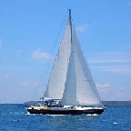
| Bareboat Monohulls | ||||||||||||||||||||||||||||
 |
2 Cabins Bavaria 30 Beneteau Oceanis 31 Bavaria 31 Bavaria 34 Cruiser [YOB - 2008] [Athens] 3 Cabins Jeanneau Sun Odyssey 36i Bavaria 38 NB - Year of Build [YOB] normally refers to the year the boat was launched but can also refer to the year of the last major overhaul/refit |
4 Cabins Sun Odyssey 40.3 Bavaria 44 Sun Odyssey 45DS Bavaria 46 Bavaria 47 Beneteau Oceanis 473 Jeanneau Sun Odyssey 49DS 5+ Cabins Bavaria 50 NB - The option of a Skipper is normally available with these boats. Please get in touch for more details and rates for Skippers |
||||||||||||||||||||||||||
 |
||||||||||||||||||||||||||||
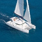
| Bareboat Catamarans | ||||||||||||||||||||||||||||
 |
Under 12 metres - Lagoon 380 12 - 15metres - Lagoon 400 | Dufour Nautitech 44 | Dufour Nautitech 47 NB - The option of a Skipper is normally available with these boats. Please get in touch for more details and rates for Skippers |
|||||||||||||||||||||||||||
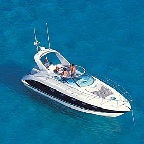
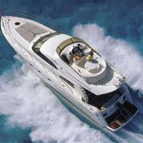
| Bareboat Motor Yachts | ||||||||||||||||||||||||||||
 |
Under 12 metres - 12 - 15 metres - NB - The option of a Skipper is normally available with these boats. Please get in touch for more details and rates for Skippers |
|||||||||||||||||||||||||||
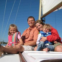
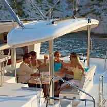
| Skippered & Crewed Boats | ||||||||||||||||||||||||||||
 |
||||||||||||||||||||||||||||
